MSR / MSCB Photos: Exterior
Miscellaneous, Gallery A
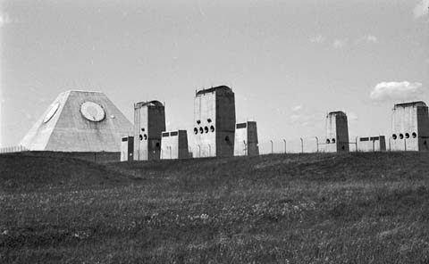
Gallery A
Photos from the north, northwest, west, southwest, and south.-
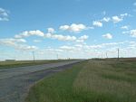
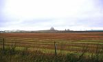
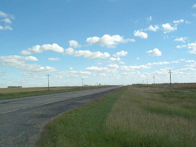
04104 : First sight of the MSR heading south on N.D. Highway 1 (2001).-
(392 x 295 = 20k) Show | Omit descr (04104)
(791 x 595 = 67k) Show | Omit descr - Photo by Earl and Dee Raymond.
-
(392 x 295 = 20k) Show | Omit descr (04104)
-
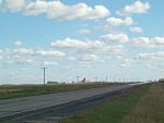
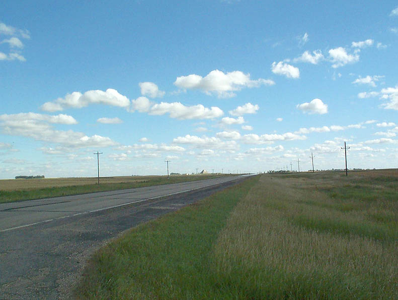
04105: Closer view of the MSR heading south on N.D. Highway 1 (2001).-
(393 x 295 = 19k) Show | Omit descr (04105)
(793 x 595 = 56k) Show | Omit descr - Photo by Earl and Dee Raymond.
-
(393 x 295 = 19k) Show | Omit descr (04105)
-
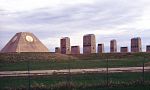
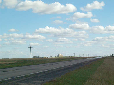
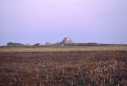
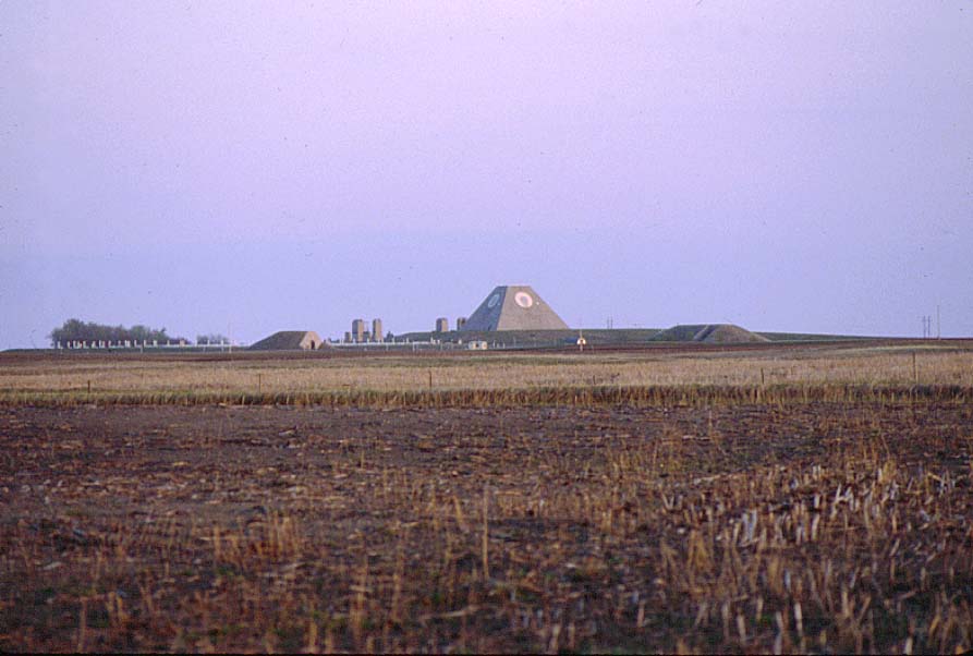
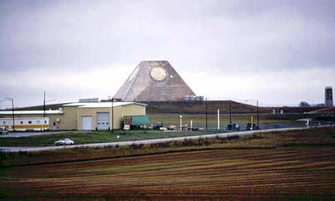
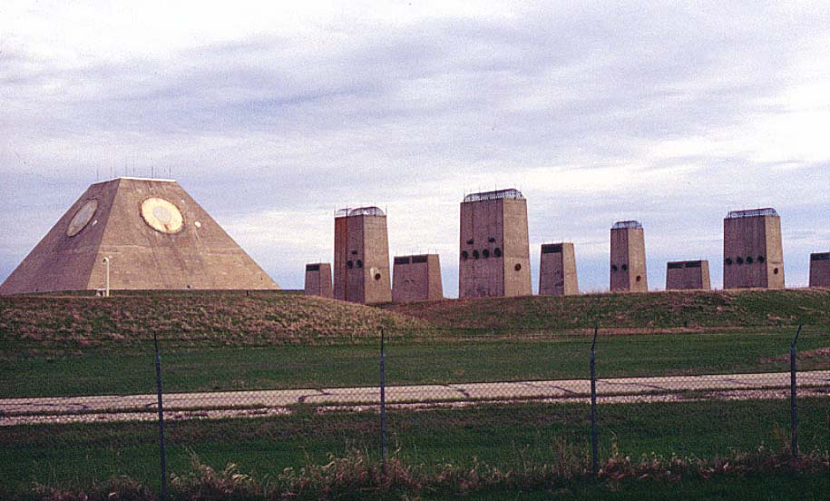
00503: Photo from the northwest, taken at sunset from N.D. Highway 1 (1999).-
Left to right:
Missile fields, warhead building, generator intake/exhaust ports, MSR, universal missile building. -
(440 x 297 = 20k) Show | Omit descr (00503)
(893 x 602 = 65k) Show | Omit descr
-
Left to right:
-
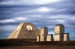
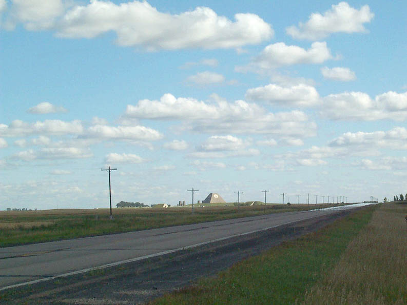
00402: Photo from the northwest, taken from N.D. Highway 1 (closer version of 00503) (1999).- Left: Exclusion area sentry station (EASS).
- Center: emergency exit can be seen below the MSR pyramid.
- Right: universal missile building.
-
(450 x 296 = 20k) Show | Omit descr (00402)
(894 x 588 = 98k) Show | Omit descr
-

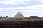
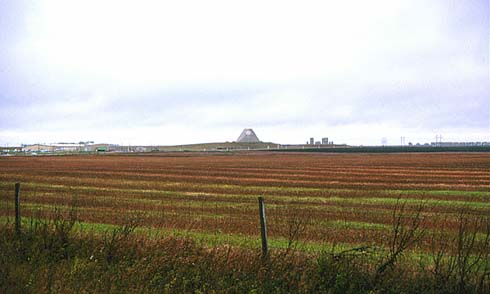
00614: Photo from the southwest (1977).- De-commissioning is in progress in this 1977 photo as evidenced by the de-installed equipment sitting around the base of the MSR pyramid.
- Some of the administrative / support facilities can be seen on the left.
-
(485 x 291 = 22k) Show | Omit descr (00614)
(913 x 547 = 82k) Show | Omit descr
-
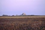
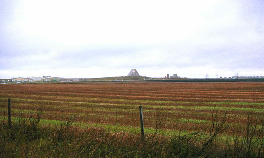
00603: Photo from the southwest, taken from just outside village of Nekoma (1977).- Part of the administrative / support area can be seen on the left.
-
(490 x 294 = 24k) Show | Omit descr (00603)
(909 x 546 = 70k) Show | Omit descr
-

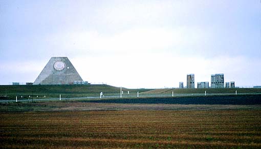
00608: Closer version of photo from the southwest, taken from just outside village of Nekoma (1977).- The short white pole-like structures are the light standards that lined all roads in the complex but have since been removed.
- Generator intake / exhaust ports are on the right.
-
(510 x 291 = 22k) Show | Omit descr (00608)
(962 x 549 = 89k) Show | Omit descr
-
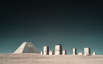
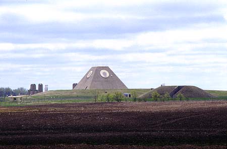
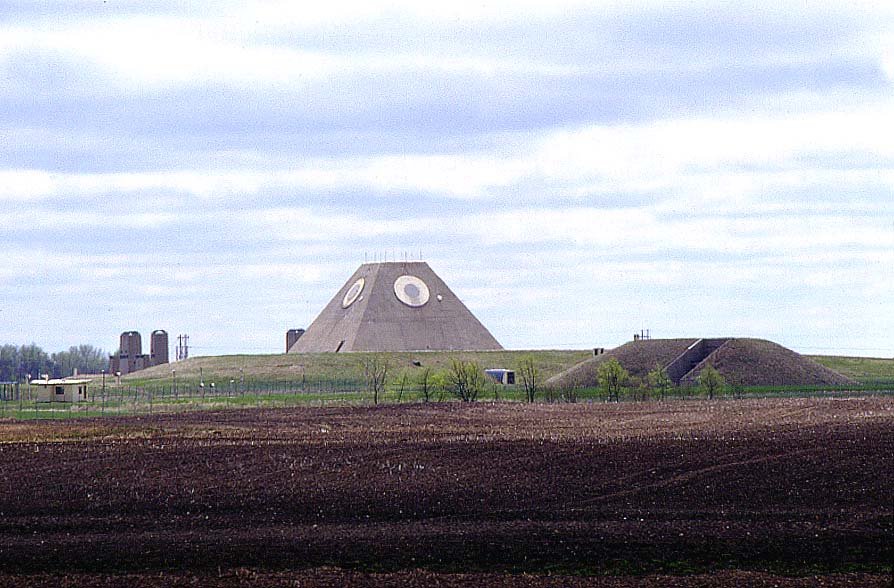
00520: Closeup photo from the south (1999).
-

00911: Closeup photo from the south (1982).
-

J002: MSR winter 2016.- (M) (L)
- Photo by Janet Schill (via Facebook (2)).
-
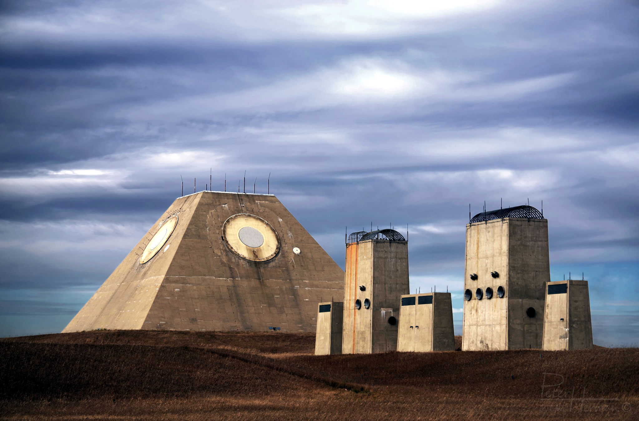
H050: MSR & power plant. <$- (M) (L)
- Photo by Peter Herman (New Window)
-
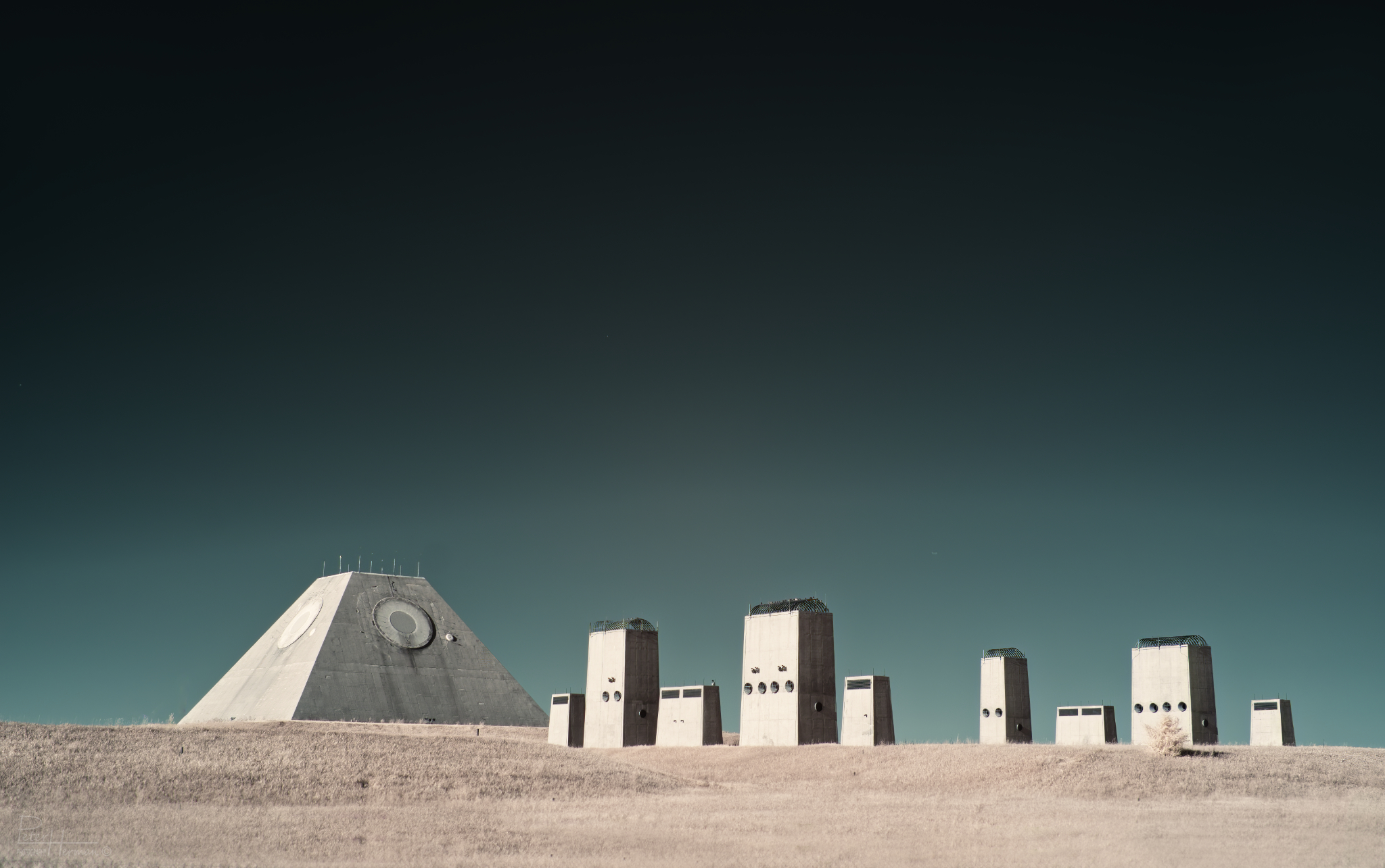
H051: MSR & power plant (infrared-spectrum modified camera (>720nm wavelength)). <$- (M) (L)
- Photo by Peter Herman (New Window)


