Home > System Components > MSR Complex > MSR Admin / Housing Areas >
Admin/Housing Photo Galleries > Galleries A & B (No Thumbnails)
MSR Admin/Housing Areas Galleries A & B (No Thumbnails)
Gallery A (Thumbnails)-
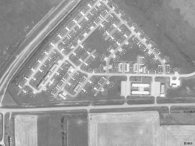
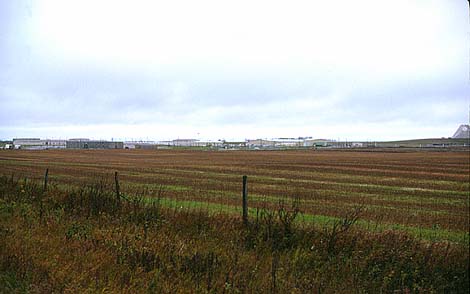
A01:
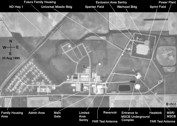
USGS high altitude aerial photo of the MSR complex family housing area (1990).
- The actual housing units were moved to Grand Forks AFB after the site was deactivated.
- The intersection of N.D. Hwy 1 and the MSR complex access road is just out of view on the lower left edge of the photo.
- Photo A02 continues this photo to the east (right).
-
(390 x 293 = 22k) Show | Omit descr (001713)
(800 x 600 = 44k) Show | Omit descr
-
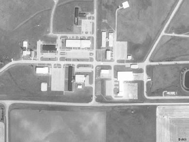
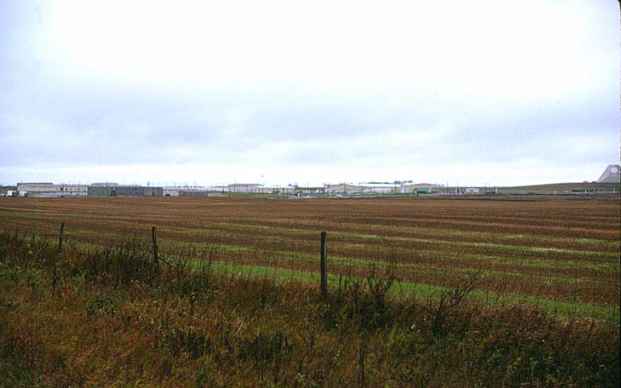
A02:
USGS high altitude aerial photo of the MSR complex administrative area (1990).
- Continuation of photo A01 from the west (left).
- The west end of the reservoir adjacent to the MSR can be seen at the right edge of the photo.
-
(390 x 293 = 18k) Show | Omit descr (001712)
(800 x 600 = 35k) Show | Omit descr
-
A03v:
Video: MSR complex support facilities.
-
Family housing
BEQ
Dispensary
PX
Gym
Chapel - wmv, 00:31 (320 x 240 = 2.88m) 005010
- From A 20-Year History of the Antiballistic Missile Program.
-
Family housing
-
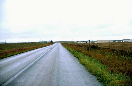
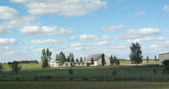
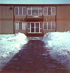
A04:
Admin / housing areas from the west at sunset, taken from N.D. Highway 1 just before the turnoff to the MSR complex access road (1999).
-
A05:
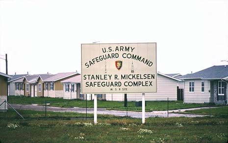
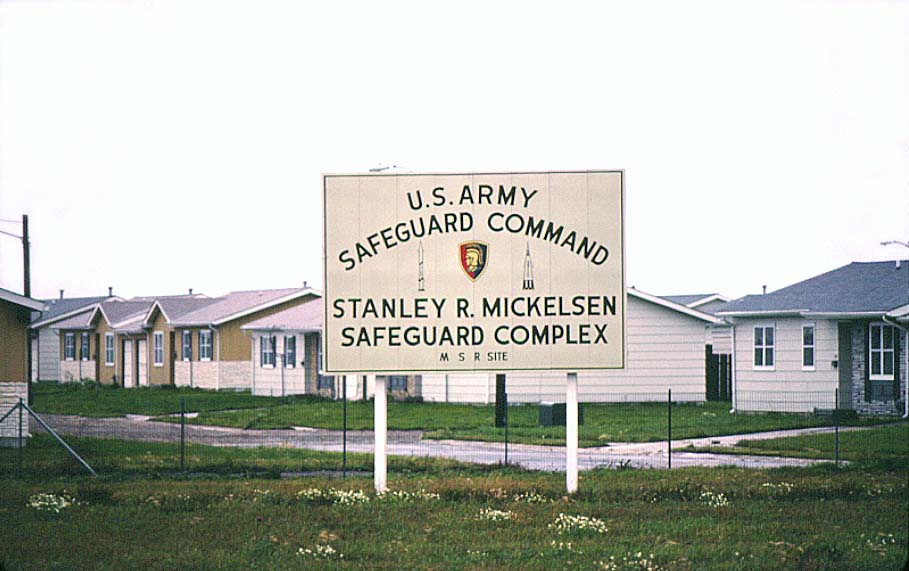
Safeguard Command / MSR Complex sign at southwest corner of the MSR site (1977).
- The MSR Complex was operated by the Army Safeguard Command, Grand Forks, with an authorized strength of 784 personnel. This number consisted of 62 officers, 22 warrant officers, 432 enlisted men, and 168 civilians. Their mission was to "defend the continental United States from a ballistic missile attack; specifically, to establish an area defense for existing retaliatory missile sites."
- A subordinate unit, the Army Surveillance Battalion, Grand Forks, operated the PAR (Perimeter Acquisition Radar).
- Family housing units are in the background; these units were moved to Grand Forks AFB after shutdown of the Safeguard system.
- This sign now hangs in the level one hallway of the PAR building at Cavalier Air Force Station.
-
(465 x 292 = 26k) Show | Omit descr (000629)
(909 x 571 = 76k) Show | Omit descr
-
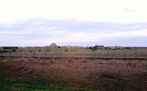
A06:
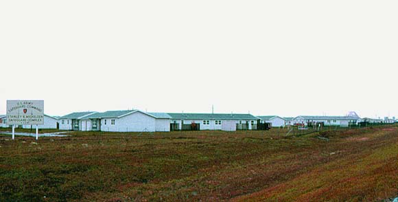
Family housing units seen from the access road just after turning off N.D. Highway 1 (1977).
- This housing area was to be designated for enlisted personnel with a second housing complex for officers planned north of the admin area. This second housing area was never constructed although the streets were completed and are visible in the USGS high altitude photo of the complex.
- The MSR pyramid is visibile in the background on the right.
-
(580 x 294 = 24k) Show | Omit descr (000628)
(910 x 462 = 62k) Show | Omit descr
-
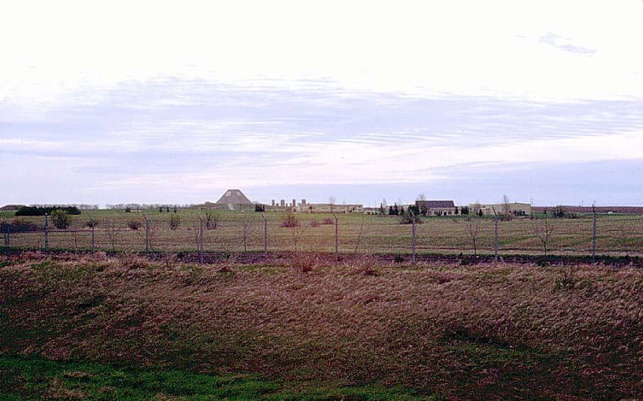
A07:
Empty sign frame and former family housing area (1999).
- See A05, A06 for 1977 version.
-
(450 x 292 = 16k) Show | Omit descr (000406)
(911 x 591 = 60k) Show | Omit descr
-
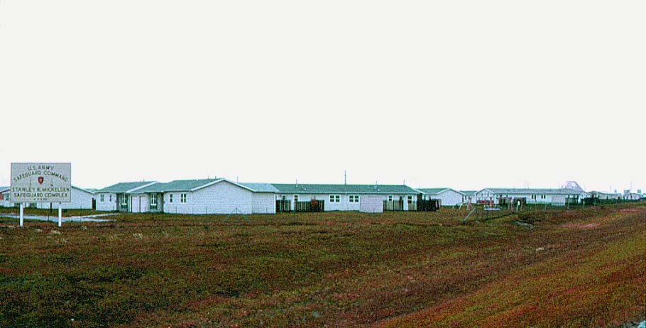
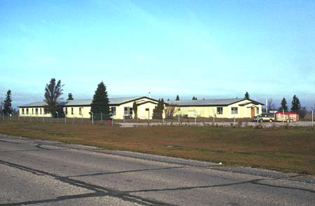
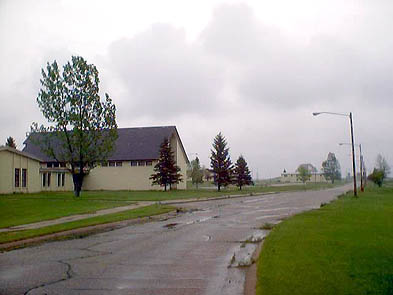
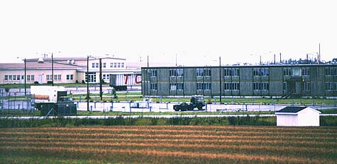
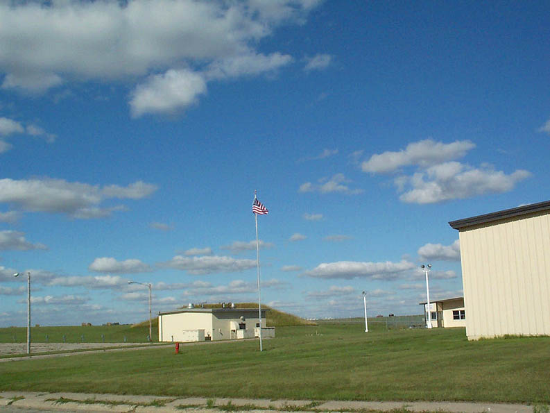
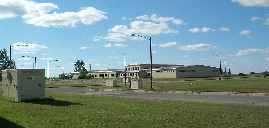
A08:
Admin / housing areas from the southwest, taken from the MSR complex access road (1999).
- The building in the center was the "H" building (since removed). It was shaped like the letter H. During construction, the Corps of Engineers used it as their headquarters. After construction was completed and the site activated, the admin building became the headquarters and the H building was used for general office space (housing office, re-enlistment office, print/copy service, etc.).
-
(595 x 271 = 24k) Show | Omit descr (000413)
(911 x 415 = 46k) Show | Omit descr
-
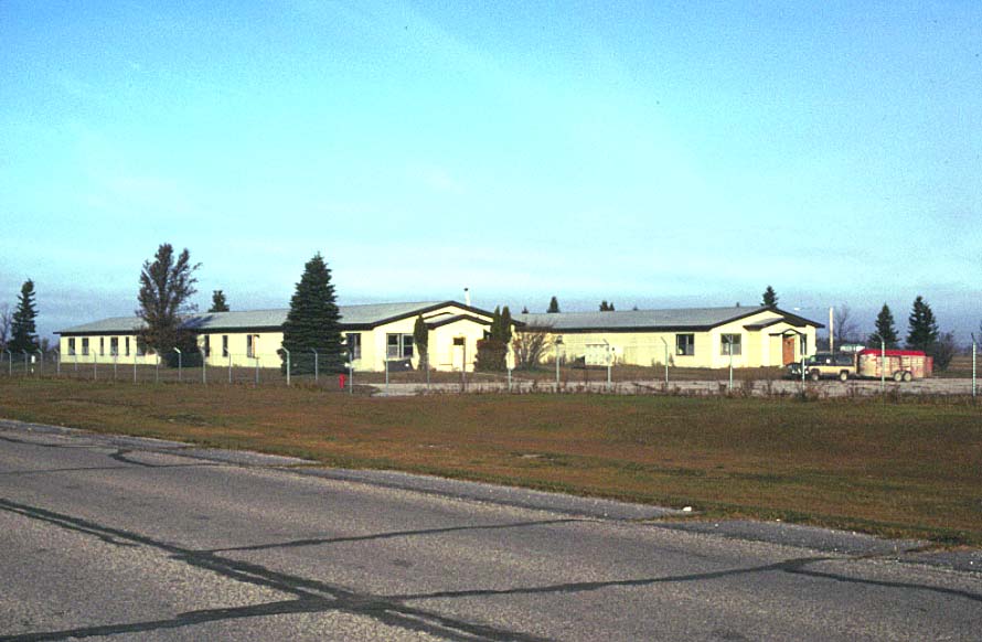
A09:
Early morning photo of the H building taken from the MSR complex access road (1999).
-
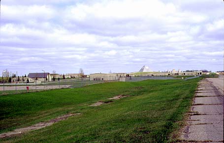
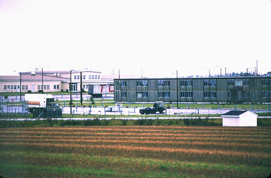
A10:
Admin area from the southwest, taken from the MSR complex access road (1999).
-
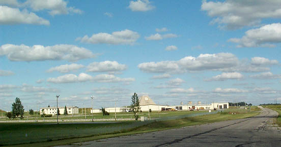
A11:
Closer version of A10 (2001).
- Admin building on the left, industrial buiding on the right, with the MSR behind.
-
(552 x 290 = 29k) Show | Omit descr (004108)
(875 x 460 = 60k) Show | Omit descr - Photo by Earl and Dee Raymond.
-
A12:
View toward the north and the MSR complex from just outside the village of Nekoma (1977).
- The family housing area is just out of view to the left.
- The chapel is just to the right of center.
-
(445 x 293 = 21k) Show | Omit descr (000605)
(905 x 595 = 66k) Show | Omit descr
-
A13:
View toward the northeast and the main admin area from just outside the village of Nekoma (1977).
- The flag is flying at the administration building in the center of the photo.
-
(470 x 294 = 25k) Show | Omit descr (000604)
(898 x 562 = 79k) Show | Omit descr
-
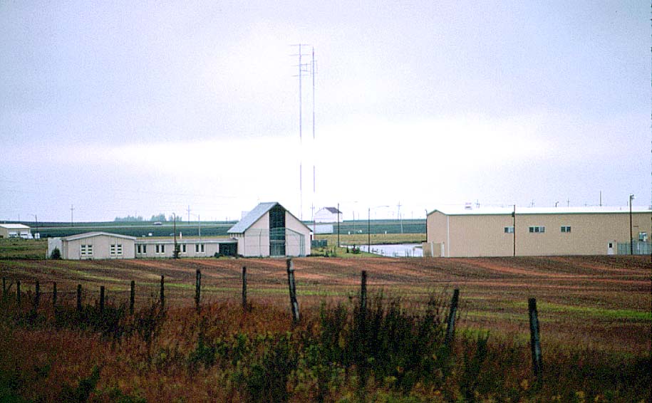
A14:
Chapel (left), gymnasium (right) (1977).
-
A15:
Except for the tree growth, the Chapel and annex appear little changed in this 2001 photo (2001).
-
(555 x 295 = 29k) Show | Omit descr (004107)
(875 x 465 = 60k) Show | Omit descr - Photo by Earl and Dee Raymond.
-
(555 x 295 = 29k) Show | Omit descr (004107)
-
A16:
Chapel (from the west) with admin building and MSR in background (2003).
-
(393 x 295 = 23k) Show | Omit descr (004150)
(640 x 480 = 42k) Show | Omit descr - Photo by Mark Morgan.
-
(393 x 295 = 23k) Show | Omit descr (004150)
-
A17:
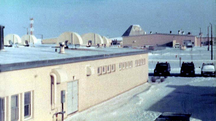
Admin area buildings (2001).
- Left to right: gym, community center (mostly behind gym), universal missile building (earth mound), admin building, industrial building.
-
(550 x 292 = 29k) Show | Omit descr (004109)
(875 x 465 = 61k) Show | Omit descr - Photo by Earl and Dee Raymond.
-
A18:
Closer version of A17 with a better view of the community building (2001).
- The enlisted quarters and dining hall originally stood just beyond the parking lot on the right.
-
(505 x 295 = 28k) Show | Omit descr (004110)
(875 x 511 = 70k) Show | Omit descr - Photo by Earl and Dee Raymond.
-
A19:
Community center (left), enlisted quarters (EQ) (right) (1977).
- The EQ has since been removed.
-
(475 x 232 = 28k) Show | Omit descr (000617)
(906 x 596 = 88k) Show | Omit descr
-
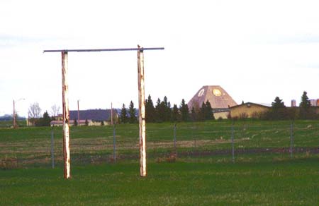
A20:
Closer view of the community center (2001).
- The short pole-like structures called "hitching posts" are seen in most parking lots. They provided electrical outlets for engine block heaters, a necessity for the frequent sub-zero winter days.
-
(620 x 221 = 27k) Show | Omit descr (004101)
(975 x 348 = 54k) Show | Omit descr - Photo by Earl and Dee Raymond.
-
A21:
Entrance to the PX in the community center building (1975).
-
If you can identify anyone in the photo, please
 the webmaster.
-
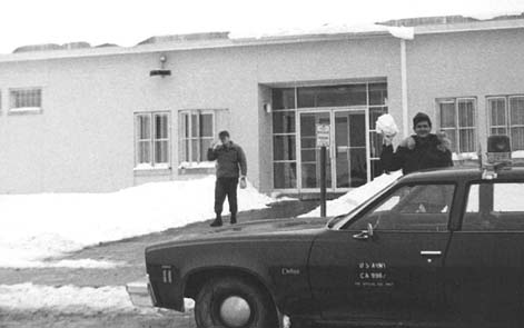
From Bill Carrothers: <$
The resolution is not very good but I am pretty sure the person coming out of the PX complex is John Kay, MP from the 3rd platoon. Don’t recognize the guy with the snowball. -
(471 x 295 = 036k) Show | Omit descr (004033)
(950 x 595 = 121k) Show | Omit descr - Photo by John Thompson.
-
If you can identify anyone in the photo, please
-
A22:
Off to a movie at the community center (leaving the enlisted quarters) (1975).
- Note the lost glove stuck on the pole (right).
-
(453 x 295 = 15k) Show | Omit descr (004030)
(914 x 595 = 48k) Show | Omit descr - Photo by John Thompson.
-
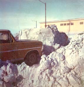
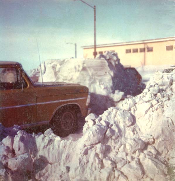
A23:
Ford pickup pulled in against what used to be a 5-6 foot drift in the PX (community center) parking lot (1975).
-
(285 x 295 = 19k) Show | Omit descr (002602)
(598 x 620 = 47k) Show | Omit descr - Photo by Dale Whitacre.
-
(285 x 295 = 19k) Show | Omit descr (002602)
-
A24:
Dispensary (medical facility) (1975).
- Like the enlisted and officers quarters, the dispensary has been demolished.
-
(472 x 295 = 15k) Show | Omit descr (004032)
(952 x 595 = 50k) Show | Omit descr - Photo by John Thompson.
-
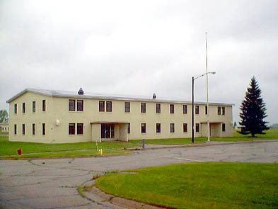
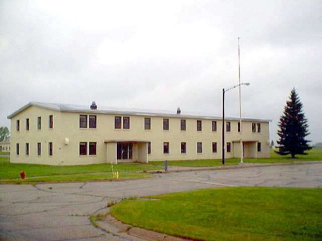
A25:
Enlisted quarters (EQ) (left), administration building (right, with flag flying) (1977).
- The buff colored building just to the right of the EQ was the enlisted mess (dining) hall. The enlisted men's club and a fallout shelter were on the lower level.
-
(480 x 293 = 20k) Show | Omit descr (000610)
(924 x 564 = 67k) Show | Omit descr
-
A26:
Closer view of the enlisted mess from the second floor of the enlisted quarters (1976).
-
(527 x 295 = 26k) Show | Omit descr (004603)
(732 x 410 = 50k) Show | Omit descr - Photo by Greg Preston.
-
(527 x 295 = 26k) Show | Omit descr (004603)
-
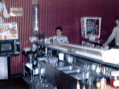
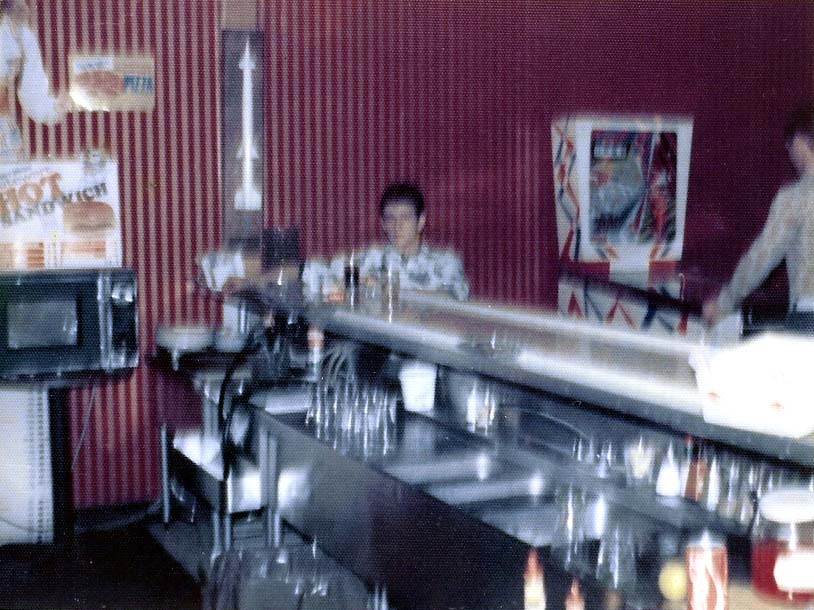
A27:
MP Ronnie Robertson at the bar in the NCO club (1976).
-
(394 x 295 = 025k) Show | Omit descr (004616)
(814 x 610 = 102k) Show | Omit descr - Photo by Greg Preston.
-
(394 x 295 = 025k) Show | Omit descr (004616)
-
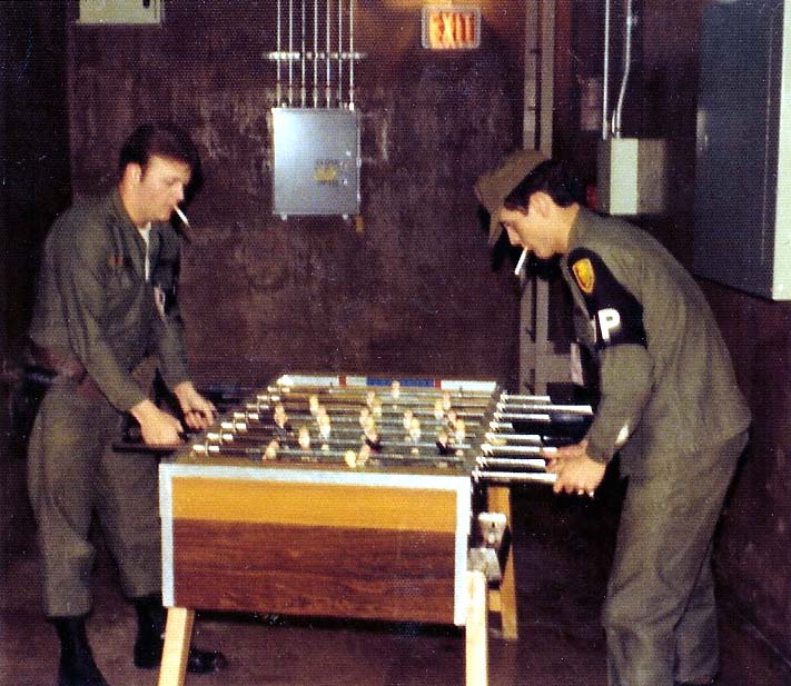
A28:
Foosball at the NCO club (1976).
- Willie Fuller (left), Ronnie Robertson (right).
-
(340 x 295 = 24k) Show | Omit descr (004625)
(711 x 617 = 87k) Show | Omit descr - Photo by Greg Preston.
-
A29:
MP's standing next to the enlisted quarters (1975).
- This is the north entrance to the EQ. In the background the gym can be seen on the left, the chapel on the right.
- Second from the left is Patty Cich (ID'd by Brad Paul.)
- Far right is Mary Cooper (ID'd by Mike Howdle.)
-
If you can identify the others in the photo, please the webmaster.
-
(434 x 295 = 21k) Show | Omit descr (004029)
(875 x 595 = 64k) Show | Omit descr - Photo by John Thompson.
-
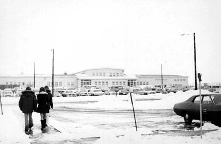
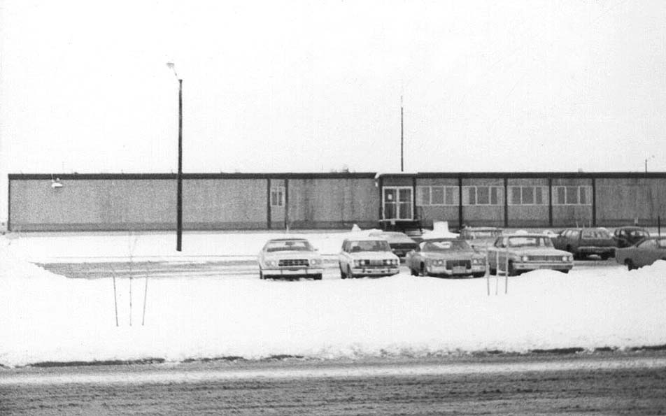
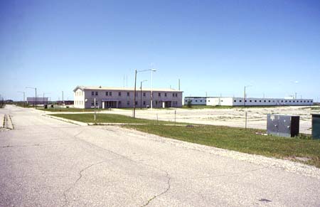
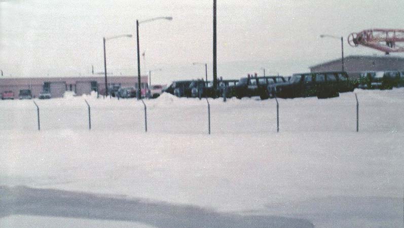
A30:
A busy winter day in the admin area (1975).
- Left to right: Community center, admin building, MSR, enlisted quarters.
-
(438 x 295 = 16k) Show | Omit descr (004035)
(884 x 595 = 51k) Show | Omit descr - Photo by John Thompson.
-
A31:
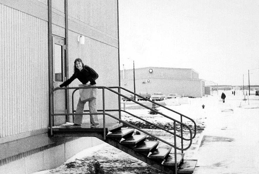
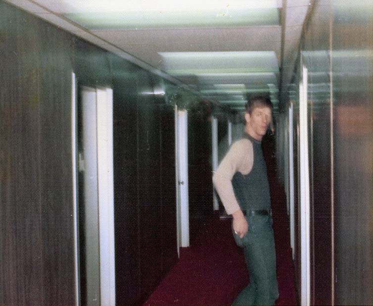
Unidentified MP entering the enlisted quarters (1975).
- This is the north entrance to the EQ; the gym is in the background.
-
If you can identify the person in the photo, please the webmaster.
-
(438 x 295 = 22k) Show | Omit descr (004028)
(884 x 595 = 74k) Show | Omit descr - Photo by John Thompson.
-
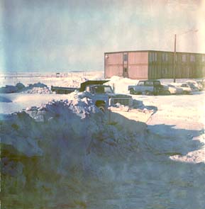
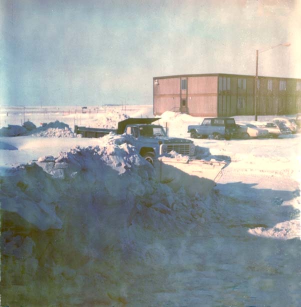
A32:
West entrance to the enlisted quarters (EQ) with about 4 feet of snow drift (1975).
-
(283 x 295 = 19k) Show | Omit descr (002600)
(592 x 617 = 54k) Show | Omit descr - Photo by Dale Whitacre.
-
(283 x 295 = 19k) Show | Omit descr (002600)
-
B01:
Greg Preston's room in the enlisted quarters (1976).
- (rear, l-r): MP's Joe Auchus, Greg Preston, Ronnie Robertson, David Staire
- (front center): MP Mark Avery
-
(427 x 295 = 27k) Show | Omit descr (004615)
(765 x 529 = 84k) Show | Omit descr - Photo by Greg Preston.
-
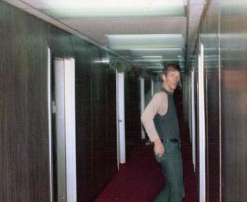
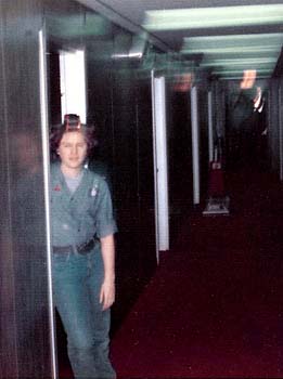
B02:
MP Tim Littlefield entering his room in the enlisted quarters (1975).
-
(360 x 295 = 17k) Show | Omit descr (004621)
(754 x 618 = 81k) Show | Omit descr - Photo by Greg Preston.
-
(360 x 295 = 17k) Show | Omit descr (004621)
-
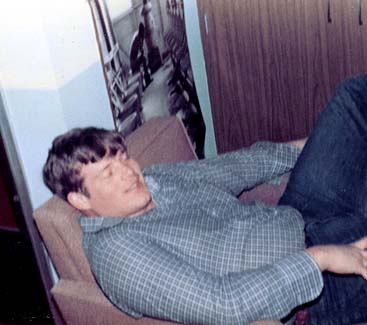
B03:
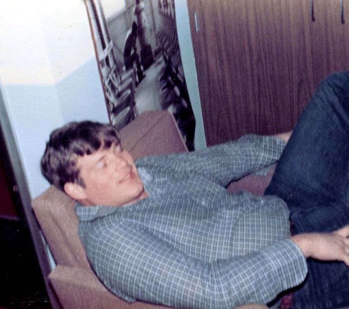
MP Dave Spots relaxes in the enlisted quarters (1976).
-
(382 x 295 = 17k) Show | Omit descr (004622)
(765 x 591 = 48k) Show | Omit descr - Photo by Greg Preston.
-
(382 x 295 = 17k) Show | Omit descr (004622)
-
B04:
MP Chris Ruth in the doorway to her enlisted quarters room (1975).
-
(261 x 350 = 16k) Show | Omit descr (004623)
(460 x 618 = 50k) Show | Omit descr - Photo by Greg Preston.
-
(261 x 350 = 16k) Show | Omit descr (004623)
-
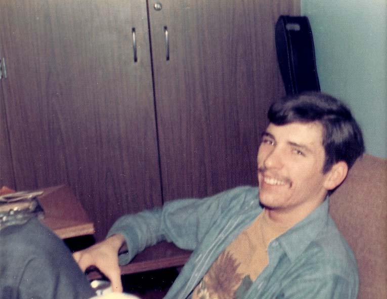
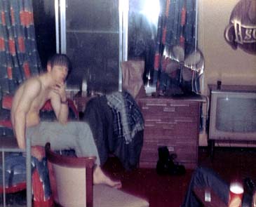
B05:
MP Chuck Whaley relaxes in the enlisted quarters (1976).
- Note the poster on the wall in the background.
-
(367 x 325 = 23k) Show | Omit descr (004624)
(694 x 614 = 62k) Show | Omit descr - Photo by Greg Preston.
-
B06:
MP Alan (Paul) Storhoff in the enlisted quarters (1976). (ID'd by Joe Auchus and Hal Gollos.)
- He was the roommate of MP Dave Spots.
-
(365 x 295 = 20k) Show | Omit descr (004632)
(751 x 607 = 61k) Show | Omit descr - Photo by Greg Preston.
-
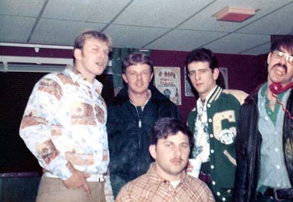
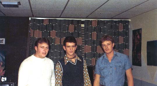
B07:
Greg Preston's room in the enlisted quarters (1976).
- (l-r): Willie Fuller, Ronnie Robertson, Greg Preston
-
(539 x 295 = 31k) Show | Omit descr (004634)
(824 x 451 = 64k) Show | Omit descr - Photo by Greg Preston.
-
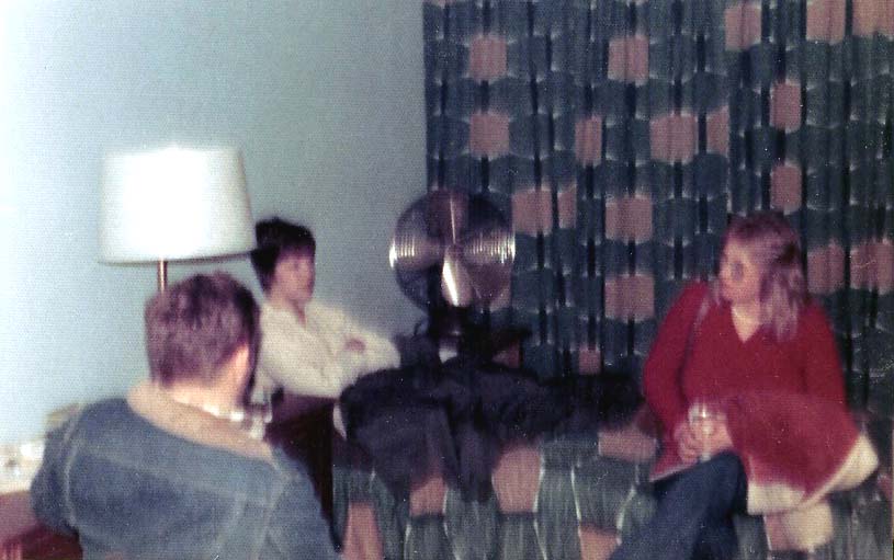
B08:
Relaxing in the enlisted quarters (1976).
- Back of MP Chuck Whaley, center is MP Penny Peterson, right is Penny's friend Rene ? (1976).
-
If you know Rene's last name, please the webmaster.
-
(470 x 295 = 23k) Show | Omit descr (004635)
(815 x 511 = 56k) Show | Omit descr - Photo by Greg Preston.
-
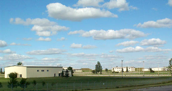
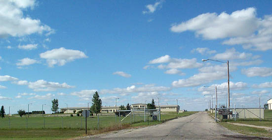
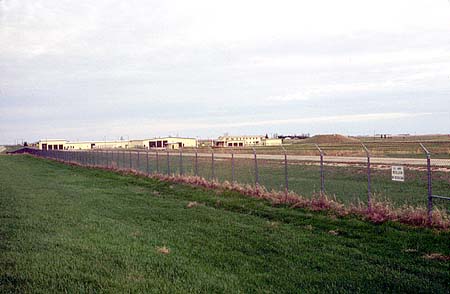
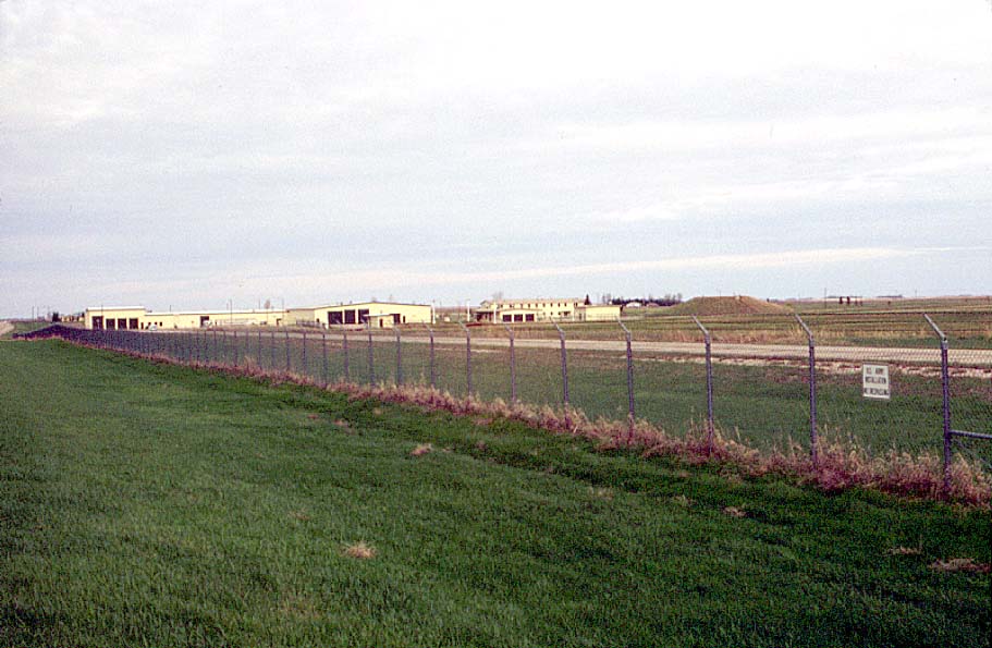
B09:
Wide view of MSR complex main gate (2001).
- The community center is in the center of the photo.
-
(551 x 285 = 29k) Show | Omit descr (004113)
(875 x 453 = 64k) Show | Omit descr - Photo by Earl and Dee Raymond.
-
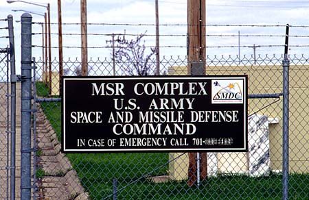
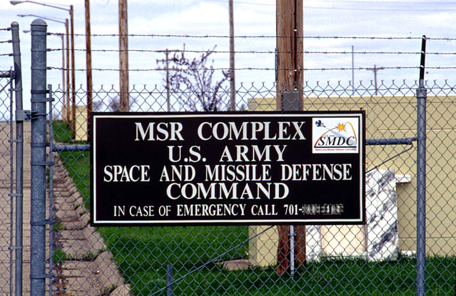
B10:
Current MSR complex sign at the main gate (1999).
-
B11:
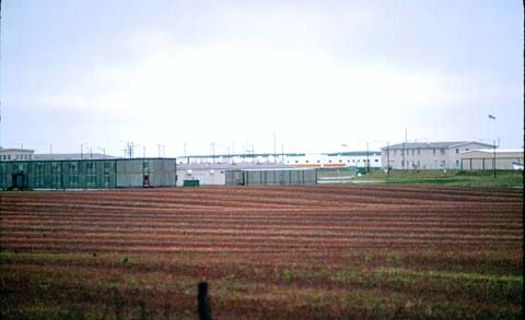
Pump house (2001).
- The LASS and industrial building are on the right.
-
(393 x 295 = 20k) Show | Omit descr (004119)
(793 x 595 = 60k) Show | Omit descr - Photo by Earl and Dee Raymond.
-
B12:
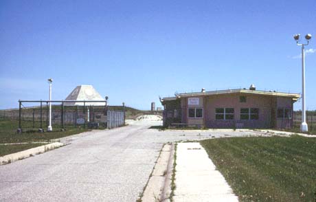
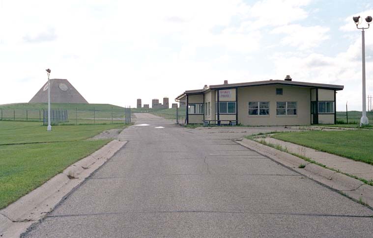
Limited area sentry station (LASS) (1982).
- This double gated sally port marked the boundary between the admin / housing areas and the tactical areas (MSR, missile fields, and missile support areas).
-
(460 x 294 = 20k) Show | Omit descr (000808)
(914 x 585 = 71k) Show | Omit descr
-
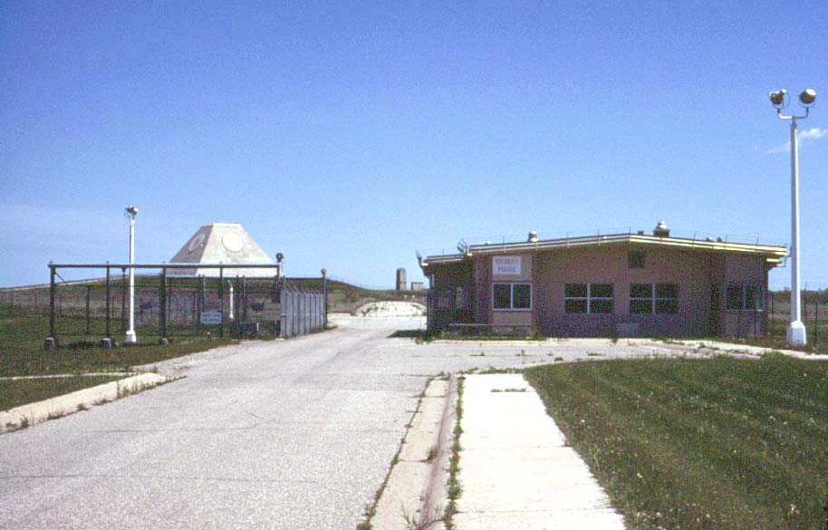
B13:
Closer view of the sally port at the limited area sentry station (LASS) (1982).
-
B14:
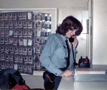
Unidentified civilian security person on duty at the LASS (1975).
- ID badges are in the background. More info about badges.
- Army MP security was augmented by civilian security personnel at the LASS and housing/admin areas. However, only MP's were used at restricted operational areas such as the MSR and EASS.
-
If you can identify the person in the photo, please the webmaster.
-
(351 x 295 = 21k) Show | Omit descr (004026)
(708 x 595 = 65k) Show | Omit descr - Photo by John Thompson.
-
B15:
Limited area sentry station (LASS) (2001).
- Most of the sally port has been removed.
-
(461 x 295 = 19k) Show | Omit descr (002815)
(759 x 485 = 42k) Show | Omit descr - Photo by Ron Plante.
-
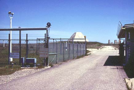
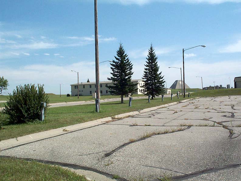
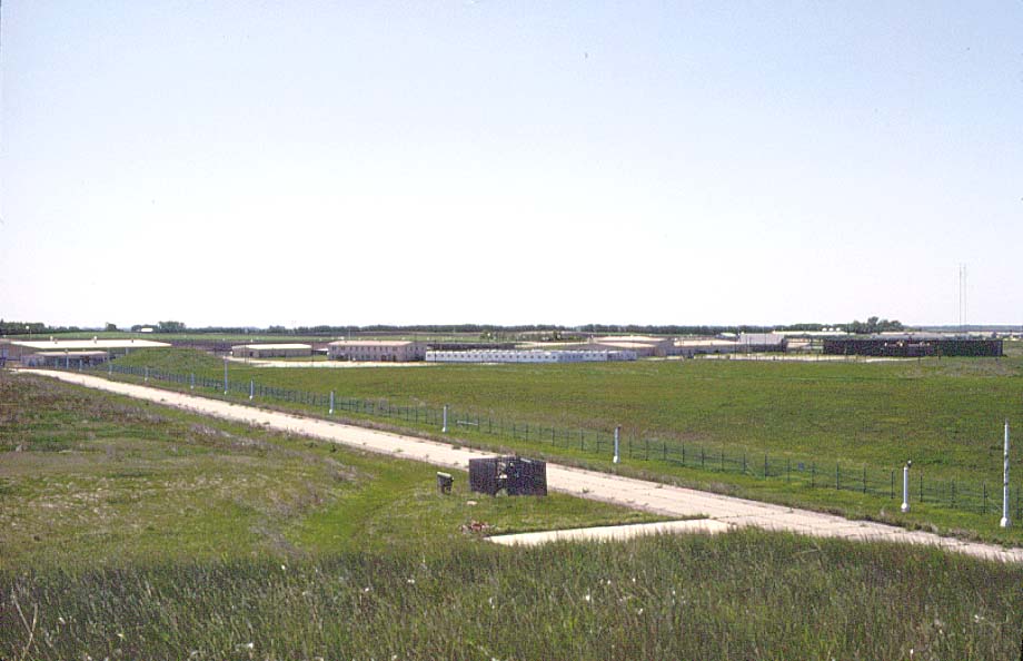
B16:
View toward the west and the admin / housing areas from the limited area sentry station (LASS) (1982).
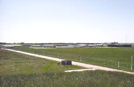
-
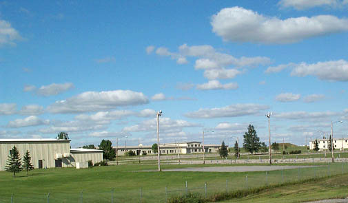
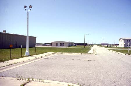
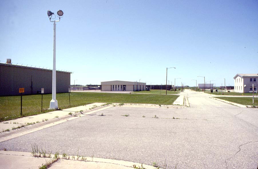
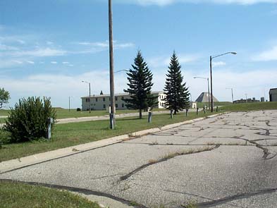
B17:
Community center as seen from the admin building / LASS / industrial building area (2001).
-
(587 x 280 = 33k) Show | Omit descr (004121)
(875 x 417 = 66k) Show | Omit descr - Photo by Earl and Dee Raymond.
-
(587 x 280 = 33k) Show | Omit descr (004121)
-
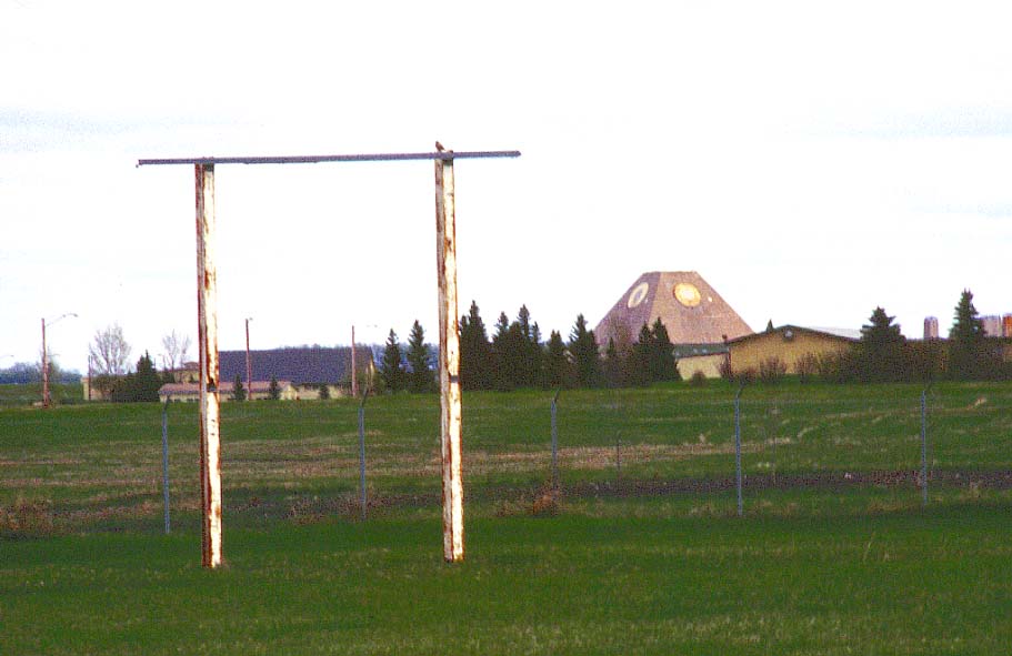
B18:
Parking lot with admin building and MSR in background (2001).
- The short pole-like structures called "hitching posts" are seen in most parking lots. They provided electrical outlets for engine block heaters, a necessity for the frequent sub-zero winter days.
-
(393 x 295 = 26k) Show | Omit descr (004102)
(793 x 595 = 96k) Show | Omit descr - Photo by Earl and Dee Raymond.
-
B19:
Administration building from the limited area sentry station (LASS) (1982).
- This building served as the headquarters building for the Mickelsen complex.
-
(450 x 291 = 22k) Show | Omit descr (000811)
(897 x 580 = 82k) Show | Omit descr
-
B20:
Admin building closeup from the east (2003).
- The pine tree has grown considerably since the 1982 photo above (B19).
-
(393 x 295 = 22k) Show | Omit descr (004152)
(640 x 480 = 37k) Show | Omit descr - Photo by Mark Morgan.
-
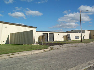
B21:
West side of the industrial building (2003).
- When the complex was operational, this building housed the PanAm supply warehouse.
-
(393 x 295 = 26k) Show | Omit descr (004120)
(793 x 595 = 93k) Show | Omit descr - Photo by Earl and Dee Raymond.
-
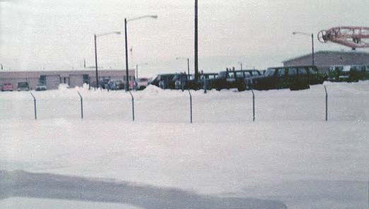
B22:
Winter view of the motor pool area (1976).
-
(522 x 295 = 20k) Show | Omit descr (004636)
(797 x 450 = 49k) Show | Omit descr - Photo by Greg Preston.
-
(522 x 295 = 20k) Show | Omit descr (004636)
-
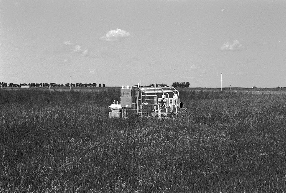
B23:
This device was part of the barometric sensing system that detected the change in air pressure from a nuclear blast and activated seals in the MSR's blast doors and shutters in the power plant stacks to prevent damage. (1982)
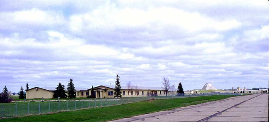
-
B24:
View of the admin / housing areas from the southeast (1999).
- The MSR is out of view to the right.
- The industrial building is on the left, the admin building is in the center.
- The access road going out to N.D. Highway 1 can be seen at the extreme left of the photo.
-
(450 x 294 = 25k) Show | Omit descr (000521)
(911 x 595 = 94k) Show | Omit descr
-
B25:
View toward the southwest and the admin / housing areas from the universal missile building (1982).
- The administration building is just to the left of center.
- The rear of the community center is just to the right of center.
- The officers' quarters (BOQ) is the dark building on the extreme right. The smaller dark building on the near side of the BOQ was the offiers' dining hall, with officers' club and a fallout shelter on the lower level.
-
(450 x 291 = 22k) Show | Omit descr (000813)
(920 x 594 = 72k) Show | Omit descr
-
B26:
South end of officers' quarters (BOQ), dump truck hauling away snow (1975).
-
(289 x 295 = 15k) Show | Omit descr (002603)
(602 x 614 = 38k) Show | Omit descr - Photo by Dale Whitacre.
-
(289 x 295 = 15k) Show | Omit descr (002603)